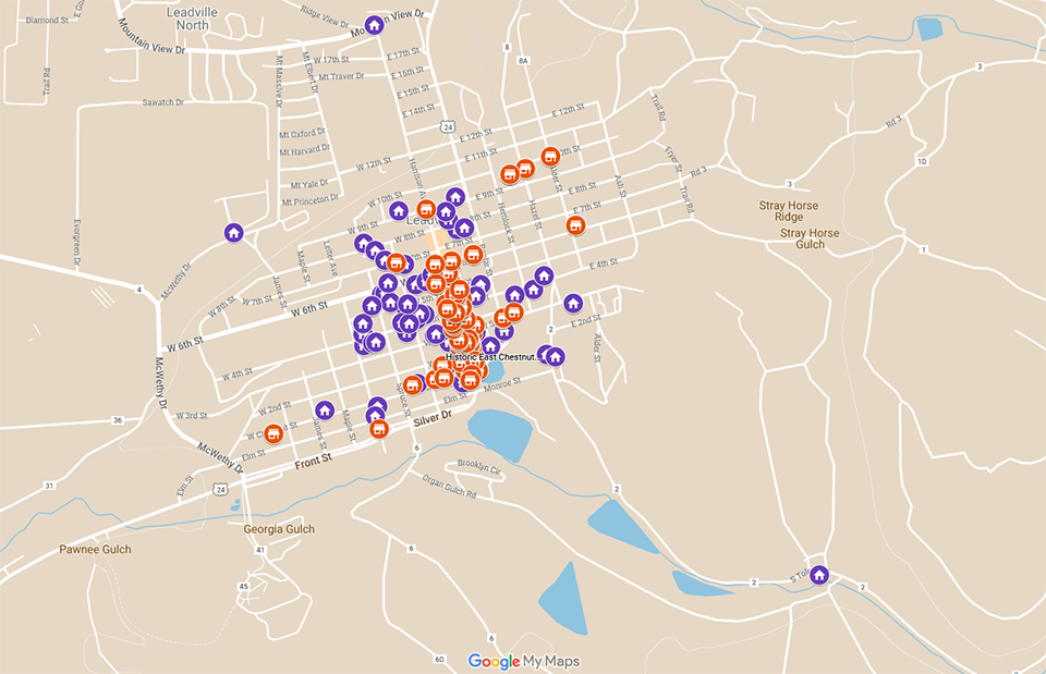
We are working on a map project that records the locations by year of residences, businesses, and other relevant information of Leadville Jews. Each map shows one year, and the comparison of each yearly map shows a general progression of where Leadville Jews lived and worked. These maps provide another level of understanding by cross referencing our researched information in a more interactove format.
Note: These maps are continually being updated to adjust and correct information. If you happen to find any obvious errors, we might already know about them, but please let us know if you wish!
Gold buttons are active maps, while gray buttons are still in development and not yet available.
We also have an online spreadsheet^ we created of indiviuals with their residences and businesses to map out by year from 1879 through 1930. Buttons to the spreadsheet and to the Surname Index are below.
^This spreadsheet through Google Sheets is read only.